

Hiking and touring
In cooperation with the Schladming-Dachstein region we have put together a selection of the most beautiful hikes including stunning views at the Dachstein and the surrounding area!

The Dachstein mountain pasture area

The Ramsau high plateau stretches for around 18 km along and 3 km across the southern slopes of the Hohe Dachstein.
In the mountain pasture region up to an altitude of 1,900m it is possible to walk either on gentle hiking paths or steeper trails up to the vertical rock faces of the southern sides of the Dachstein.
The car park at the cable car valley station is also the departure point for hikes to the mountain pastures.
Walking from the Hunerkogel mountain station across the glacier to the summit of the Hohe Dachstein, you reach high alpine
terrain with all its fascinating features.

Touring-tips
Note: Due to glacier changes, the accessibility of routes and paths may vary during the summer and autumn months, meaning that safe passage cannot be guaranteed at all times. Any traversal is undertaken at your own risk and is only recommended with appropriate equipment, sufficient experience, and in the company of a mountain guide.
HIKE TO THE DACHSTEINWARTE
DACHSTEIN CIRCULAR HIKING TRAIL
FROM THE HUNERKOGEL VIA THE GUTTENBERGHAUS LODGE TO KULM
Dachstein Kircherl
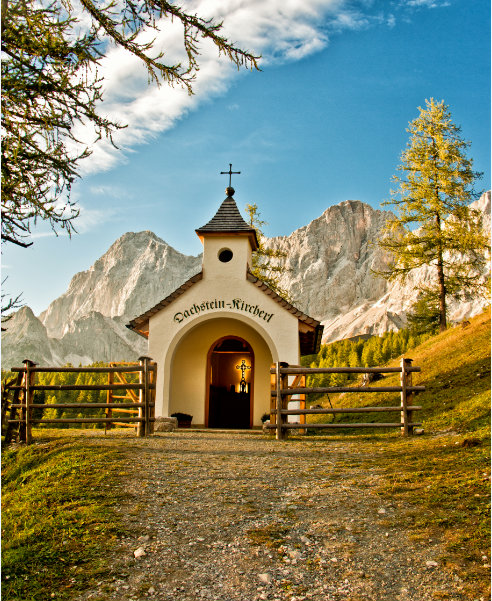
A mountaineering memorial and the Dachstein Kircherl commemorate the mountaineers who have fallen in the Dachstein region since 1879. The excursion destination at the foot of the Dachstein is located in the mountain pasture area between the glacier railway and Ramsau, above the Brandalm.
The Kircherl is around 30 minutes' walk from the Dachstein cable car valley station.
Kennst Di aus, woaßt, wos i moan?
A Berg is nix anders wia a mords Trum Stoan.
Aba drob'n auf'm Gipfel, des sog i allemoi,
is' vui schena wie drunt'n im Toi!


